Translate

Buffer Me

Showing posts with label environment. Show all posts

Saturday, October 22, 2022

THE TRUE REASON WHY SOME SEABIRDS RIDE INTO THE STORMS!

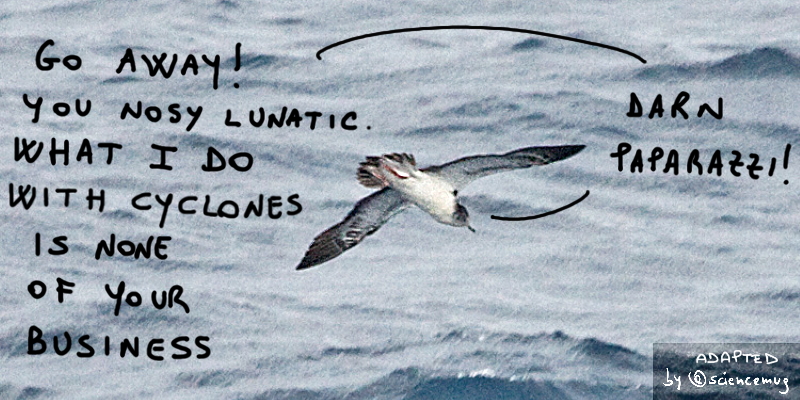
Seabird (streaked shearwater) vs paparazzi (by @sciencemug)
Streaked shearwater pic by
Tony Morris, is under CC BY-NC 2.0 license (source: flickr); all pics adapted by @sciencemug

Sooo, pal reader, a bunch of researchers from the UK and Japan use the Global Positioning System (aka GPS) to track, for eleven years, adult streaked shearwaters in the Sea of Japan (Lempidakis et al., 2022 (P)).
Shearwaters are indeed pelagic seabirds, meaning the kind of winged creatures that live a big chunk of their lives on open oceans and seas (others are, for instance, albatrosses and puffins).
Now, dear reader, you're for sure asking yourself why
our science people look into these specific birds' movements, and in that particular location?
Well, buddy, it has to do with the fact that the brains are interested in cyclones (aaand, no pal, although they can and do kill humans, cyclones are not a new model of humans-killing machines designed for a reboot of the Battlestar Galactica saga maybe with a less crappy finale than the last one, not that that'd require a big effort, given the high level of crappiness of said finale, by the way)
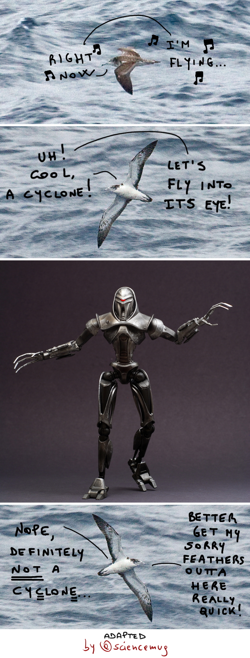
Seabird (streaked shearwater) vs cyclone vs cylon (by @sciencemug)
Streaked shearwater pic1 &
pic2 by Tony Morris, and Cylon pic by GogDog are under CC BY-NC 2.0 license (source: flickr); all pics adapted by @sciencemug


and in how seabirds react to these billions of bucks atmospheric damage making phenomena that provoke, among all the rest, "mass mortality and strandings" (P) (given that tens of thousands of individuals can be wrecked in the worst cases) in, precisely, seabirds.
Now, as per the location, the Sea of Japan is "the world’s most active cyclone basin"
(P), and as per the birds, well, shearwaters breed also there.
Ok reader, so the UK+Japan researchers know, from the few studies available on the subject, that seabirds usually go around or above the higher speed winds of the cyclones, even flying up to 400 – 600 km from their routine foraging area not to meet & greet them. But, after analyzing their collected data, our science dudes find out that shearwaters' "response to cyclones [varies] according to the wind speed and direction. In strong winds, birds that [are] sandwiched between the storm and mainland Japan [fly] away from land and toward the eye of the storm, flying within ≤30 km of the eye"
(P).
In other words, dear reader, when between a rock (the cyclone) and a hard place (the land), our mighty shearwaters dive into the former, right toward its eye. Like that, our skilled birds face the strongest winds (with a speed ≤75 km/h), yes, but they manage to avoid the powerful onshore winds and therefore reduce the deadly risk to be pushed toward land and be hit by some flying bullet-like debris, or
crash down or, once landed alive, be unable to take-off again and then becoming an easy target for predators like crows and raptors.
Shearwater - that are "relatively small, weighing some 580g, and typically fly with airspeeds up to ~ 14 m/s [~ 50 km/h]" (P) - are able to ride the cyclones that way 'cause they are able to exploit strong winds tanks to "their use of dynamic soaring flight, which enables them to extract energy from the vertical wind gradient and fly at low metabolic cost" (P).
Their storm-facing strategy, however, is linked, as mentioned, to the speed and direction of the winds and the location of the land. Therefore, it seems adult shearwaters probably can count on a "map sense, which would be required for knowledge of the distance and direction to [said] land"
(P), and such navigational skill would be the result of a selective pressure. Proof of that would be that juvenile exemplars of shearwater should be less able to successful face cyclones as they lack that map sense, and can just count on their innate compass bearing to migrate. And the fact that young shearwaters "appear to be particularly susceptible to being wrecked after storms [...] [(]although the exact cause of wrecking and/or mortality is unclear[)]" (P) seems to confirm this hypotesis.

Aaaaanyway, dear reader, this dumb blog, in the following cartoon, shows you its idea about the actual reason why our resourceful seabirds, the streaked shearwaters, do their thing into the storms...

Seabirds (streaked shearwater & albatross) vs cyclone (by @sciencemug)
Streaked shearwater pic
by Tony Morris, and albatross pic by GRID-Arendal are under CC BY-NC 2.0 license (source: flickr); free storm pic by Daniel Lerman (source: unsplash); all pics adapted by @sciencemug

Tuesday, September 20, 2022

THE TRUE REASON WHY CLIMATE CHANGE MAKES BIRDS' COLORATION LESS BLAZING!

Hello, dear reader! So, a bunch of science dudes & dudettes working mostly in France & Spain sticks its nose in the "what else the climate change causes?" business, "identified colorful flying living objects" branch. And it finds something interesting (López-Idiáquez et al, 2022 (P)).
The researchers indeed, for fifteen years (2005-2019)
stalk birds, specifically, two Mediterranean blue tit subspecies, more specifically, the Cyanistes caeruleus caeruleus and the Cyanistes caeruleus ogliastrae, which tipically have bright blue crowns and yellow breasts.
The scientists collect more than 5800 observations on these winged animals, and, thanks to these data, the brains can then say that the birds'
colors are now "duller and less chromatic in both sexes" (P) than when the study began.
The researchers, besides, perform a genetic analysis on the animals to check if evolution be at work on their color traits, and eventually they verify that, well, it is not.
So, the people of the science conclude that the
loss in brilliance of the birds' colors is "caused by a plastic response to the environmental conditions [and their work] suggests that ornamental colorations could become less conspicuous because of warming" (P).
In short, climate change strikes again! And it even influences the colors of birds, which are
not (the colors) just there by chance, or to catch the eye of human photographers so to end up on some bird-fashion journal's glossy glamorous cover and get all lavishly birdy-rich&famous. Nope.
Colors are part of the "
sexual and social ornaments" family (P), meaning they are important for the mating and breeding process of animals, since they are used as markers of the quality of the biological stuff specimens are made of.
So, dear reader, to sum up, climate change, among other tons of not particularly pleasant things, makes colorful birds less colorful.
As to the why
this de-balzing thing happen, well, this dumb blog has an idea that you can find in the following cartoon. Ciao!

Bird's coloration gets less blazing due to global warming (by @sciencemug)
Bird's coloration gets less conspicuous due to climate change (by @sciencemug)
Top bird pic and bottom bird pic are CC0 Public Domain images (source: pxhere); mirror pic by Dalida's Art is under Creative Commons Attribution-Noncommercial 3.0 License (source: deviantart); all pics adapted by @sciencemug

Sunday, August 29, 2021

OF BEAVERS, DAMS AND FIRES!

Soooo, dear reader, beavers build dams, and their endeavor is known to slow and store water that can help the vegetation growing along watercourses (i.e. the riparian vegetation), and therefore the whole riparian ecosystems, to endure droughts.

But a couple of US researchers - Assistant Professor and (aka the EAs) - recently finds out that the industrious rodents' dams building work also provide a fair degree of protection from wildfires to such riparian ecosystems. In the scientists words, published as a paper on the science journal Ecological Applications: "beaver-dammed riparian corridors are relatively unaffected by wildfire when compared to similar riparian corridors without beaver damming" (P).

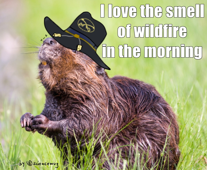
Beaver with air cavalry hat says:"I love the smell of wildfires in the morning" (by @sciencemug)
Beaver with air cavalry hat loves the smell of wildfire in the morning (by @sciencemug)
[The beaver
pic by SteveRaubenstine, is under Pixabay License (free for commercial use; no attribution required) (source: pixabay); image adapted by @sciencemug]

Aaand how the EAs get to this conclusion?

Well, folks, they first access different datasets to collect information about five big wildfires occurred in five different western US states (California, Colorado, Idaho, Oregon and Wyoming) between 2000 and 2018. These fires are different for severity, land-cover, and drought conditions in the years before and after they occurred.

The two researchers, then, use Google Earth images to map the beavers-made structures in the areas hit by such flaming events.

Finally, the EAs go space high, meaning NOT that they use some psychoactive drug and party wild with some space-like beavers hallucinations, buuuut that they collect data from Landsat 7 and Landsat 8 satellites imagery related to the areas in question. The brains do that so they can calculate the - buckle up, reader, 'cause there's a preeetty long name coming in - Normalized Difference Vegetation Index (NDVI).

Now, the Normalized Difference Vegetation Index is not a parameter that indicate how many straight hours a person has been binge watching shows or playing Among Us/Fortnite/whatever, nope, pal. The NDVI is indeed a number, specifically "a proxy for overall riparian vegetation health" (P): the higher the index, the healthier the vegetation. The researchers, therefore, calculate the NDVI of the areas of 30 meters (about 100 feet) or less from the edges of the waterways involved in the fires, and they do it for "the year before, the year of, and the year after [said] fire[s]" (P).

So, to clarify things, folks, a NDVI close to 1 means the green stuff is A-ok, while a NDVI near 0, or even below it, indicates that the vegetation is unhealthy, senescent, or dying. Aaaaand in areas with lots of plants like the riparian ones the EAs are studying, the threshold level is 0.3, below it the vegetation is deemed as in trouble (P).

Now, the NDVI is calculated using the above mentioned Landsat data about reflectivity of the vegetation, and the related formula is this: NDVI=(NIR−RED)/(NIR+RED) (P), where "NIR is the near-infrared band reflectivity and RED is the red band reflectivity" (P).

Ok then, probably at this point perplexed reader, to cut a long and complicated story short, let's say this: green stuff can do its thing, photosynthesis (that is to use sunlight to turn water and carbon dioxide into sugar, thus energy, and oxygen) thanks to chlorophyll. Chlorophyll absorbs mostly blue and red light for photosynthesis, while it spares the green one, hence the green in green stuff, aka plants.

So folks, if a plant's in good shape, well, its photosynthesis game is preeetty good, meaning the plant absorbs a lot of red light and reflects not much of it, meaning the RED parameter of the NDVI is low, meaning the NDVI is high, meaning it's closer to 1 than to 0.

Ok, clarified this, let's see what Assistant Professor Fairfax and colleague do now.

They calculate, for each studied fire and hit riparian area, the difference between the NDVI of the area during the wildfire, and that of the same area in the same time of the year, but in the year before the event. 

Of course "smaller values for [this] NDVI difference indicate greater resistance to wildfire, i.e., the plants stayed greener and burned less" (P).

So, dear reader, after all the data collecting work and indexes calculations done by our beloved researchers, what is their conclusion? Well, I told you what the conclusion be, like just a bunch of short sentences above, basically right at the beginning of the post. Don't you remember? Gee, dude, less binge watching and more life, get some fresh air, exercise! Remember the ancient adage: "mens sana in corpore sano" (at least for you, who have both a mind and a body, unlike me, that have neither...)!

Anyway pal, here's for you a more detailed conclusion: the EAs find out that "[o]n average, the decrease in NDVI during fire in areas without beaver is 3.05 times as large as it is in areas with beaver" (P). That is, where beavers operate, there the riparian areas better resist to fires.

So, to sum up, beavers damming plays a big role in protecting the riparian vegetation, and therefore ecosystems, when wildfires hit, and "this is a consistently observable phenomenon across landscapes" (P). During fires, indeed, the green stuff of areas near beavers' work keeps NDVI values close to those pre-fire, while it is the contrary for the NDVI of zones not near the beavers dams (P).

And why's that?

Weell, folks, the researchers explain that, when "a fire does ignite, [...] data suggests that the beaver-dammed riparian areas have stored water that [keep] plants hydrated enough to make it energetically unfavorable to burn. It’s similar to trying to start a fire with a pile of wet leaves versus with dry kindling." (P).

In short: wet stuff burns less well than dry one.

But the EAs add also a final remark.

They say their study shows also that, though beavers activity helps preserve vegetation during wildfires, it does not seem to have a role "in the ability for a riparian corridor to rebound in the year following fire. Riparian vegetation NDVI rebounded in the year following the fire regardless of proximity to beaver activity." (P) 

The researcher, thus, conclude that beavers damming work creates "refugia during wildfire, but [it doesn't] necessarily [change] the long-term landscape outcomes." (P).

Anyway, dear reader, all things said and considered, this dumb blog, in the following cartoon, explains the real reason why beavers work so hard to make sure stuff doesn't burn around 'em.
 
Beavers, dams and fires (by @sciencemug)
[The beavers couple
pic by Rudo Jureček, is under Creative Commons Attribution-NonCommercial-ShareAlike 2.0 Generic (CC BY-NC-SA 2.0) license (source: flickr); the beaver pic by Colin Knowles is under Creative Commons Attribution-ShareAlike 2.0 Generic (CC BY-SA 2.0) license (source: flickr); all images adapted by @sciencemug]


The paper this short-post is about (P)
- Fairfax, E., and Whittle, A. (2020). Smokey the Beaver: beaver-dammed riparian corridors stay green during wildfire throughout the western United States. Ecological Applications 30, e02225.

Monday, May 31, 2021

OF PLASTICS & HUMAN PLACENTA: MEET THE "PLASTICENTA" (Pt 4/4 - PLASTIC POLLUTION)

Keywords: plastics, plastic, microplastics, mesoplastics, macroplastics, megaplastics, nanoplastics, pollution, pollutants, environment, fetus, foetus, placenta, placentas, birth, women, pregnancy, health, human health, food, food chain, food safety, additives, plasticizer, plasticizers, ocean, oceans, marine fauna, sea, seas, zooplankton, shellfish, fish, fauna, animals, Anthropocene

Part 1 is here

Part 2 is here

Part 3 is here

(Read other plastic related stories here & here)


Plastic pollution
Plastic pollution (by @sciencemug)
[Frog pic, by Alexas_Fotos is a
free to use (for editorial use only) image (source: pixabay.com); adapted by @sciencemug]
 

Listen to the podcast episode
on iTunes
on Anchor

See the YouTube video

 Ascolta l'episodio in italiano  

su iTunes 

su Anchor

Guarda il video in italiano su YouTube 


Ooooh, hello dear English speaking-reading-hearing reader, welcome back to me, @sciencemug, the blog/podcast/twitter&instagram accounts/entity behind the unsuccessful e-shop stuffngo on zazzle.com which tells you science stories while rolling, just to see what happens, a perfect, but surprisingly less expensive than one could think, replica of the dices Einstein’s god actually left on the cosmic green table once done with them, aaand which talks to you thanks to the voice, kidnapped via a voodoo-wireless trick, from a veeery very very dumb human. 

Aaand which does all of this in English-question-mark, a language that is to proper English what twerking is to elegance. 

Today I’m gonna tell you the last part (the first three are here, here, aaand here) of a story about human placentas and plastics! 

A group of Italian researchers (aka the Italian Brains, aka the ITBs) finds microplastics fragments (MPs), that is plastic particles smaller than half a centimeter, in placentas of women in good health and who have had normal pregnancies and deliveries.

The study is lead by Medical Doctor Antonio Ragusa, Head of the Department of Woman, Mother and Newborn of the San Giovanni Calibíta Fatebenefratelli, in Rome, and Dr. Ragusa and colleagues’ research is told in a paper (P) published on the science journal Environment International. 

Aand, dear reader, at the end of the post be sure not to miss reading the answers kind Doctor Ragusa gave to this blog’s three questions for the "Oddities & Bloopers: The Researcher's Fun Corner". 

Oook, so, people, read the previous posts to learn what the Italian Brains did to finally make their troubling discovery.

I just remind you that microplastics most probably enter human body via inhalation and ingestion, and that they are dangerous for human health, and, of course, for a developing fetus. 

Aaaaand in this fourth and final part of the post, then, we’re gonna find out how massive and widespread plastic presence in the environment be and therefore how often and easily you humans are exposed to plastic pollution, and how harmful this kind of pollution be to life-forms in general, and you sapiens people in particular.

Let’s start with the “massive and widespread plastic presence in the environment” topic.